World's sea ice plunges to record low: scientists
Technology
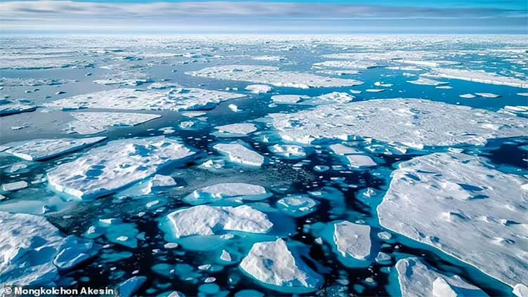
Shocking maps reveal how the North and South Poles are both missing thousands of miles of ice
(Web Desk) - It provides habitats for wildlife and reflects sunlight back to space to help keep our planet cool.
But scientists warn that the world's sea ice – the frozen ocean water at the North and South Poles – has plunged to a record low.
Shocking maps reveal how both the poles are missing thousands of miles of ice compared to the historical average (1981-2010).
Combined, Artic and Antarctic sea ice covered 15.76 million sq km (6.08 million sq miles) on Thursday (February 13), according to data from US National Snow and Ice Data Center (NSIDC).
Breaking this figure down, Antarctic had 819,308 sq miles (2.12 million km) of sea ice, while Arctic had 5.26 million sq miles (13.64 million km).
This breaks the previous five-day record low of 6.15 million sq miles (15.93 million sq km) from January-February 2023, reports the BBC.
The concerning data is constantly being collected by satellite sensors that observe the microwaves emitted by the ice surface.
Climate scientists think the worrying new low has been caused by warmer air and warmer waters, which are the result of global warming.
Sea ice – frozen seawater that floats on the ocean surface – forms in both the Arctic and the Antarctic in each hemisphere's winter.
Sea ice waxes and wanes throughout the year, but in Antarctic it reaches a minimum extent in February and a maximum in September after a long, cold winter.
In the Arctic, meanwhile, the total area covered by ice increases through the northern hemisphere's winter, usually reaching its maximum extent in early March.
So although Arctic sea ice extent is currently much greater than it would be in September and October, scientists say it's unusually low at the moment considering it should be around its greatest extent.
Since the record low registered on Thursday, the combined sea ice extent for both the Arctic and Antarctic has risen slightly.
Looking specifically at the Antarctic, sea ice extent is 801,548 sq miles (2.07 million sq km) as of February 15, 2025, the most recent day that data is available.
This is more than 200,000 miles below the February 15 average for the historical reference period between 1981 and 2010 (1.13 million sq miles/2.932 million sq km).
But it is just above the 723,941 sq miles (1.875 million sq km) recorded on February 15, 2023 – the season when Antarctic sea ice reached historically low levels.
The Antarctic has 'moved into a new regime of lower ice extents', Walter Meier, senior research scientist at NSIDC, told the BBC.
Meanwhile, in the Arctic, sea ice reaches its greatest extent in early March – but it is at its smallest recorded extent for this time of year, according to the NSIDC.
As of February 15, Arctic sea ice extent is 5.31 million sq miles (13.763 million sq km), which is also well below the February 15 average for 1981-2010 (5.92 million sq miles/15.33 million sq km).
Less Arctic sea ice is partly due to unusually warm ocean waters taking a long time to cool down, including in Canada's Hudson Bay.
Data from NSIDC recently revealed that Arctic sea ice dipped to its second-lowest extent for January in 2025.
Ice extent was down 498,000 square miles (1.29 million sq km) compared to the 1981 to 2010 average – roughly equating to an area of ice six times the size of Wales.
Conditions for sea ice have been poor due to exceptionally warm air and water temperatures, which are both symptoms of global warming.